Final West Fork Perimeter Map July 13
San Juan National Forest Closure Map, July 12 update
Rio Grande Nation Forest Closure map, July 10 update
July 10
Fire Perimeter Map, West Fork Complex
The above map is also available in a PDF version on the West Fork Complex Inciweb page.
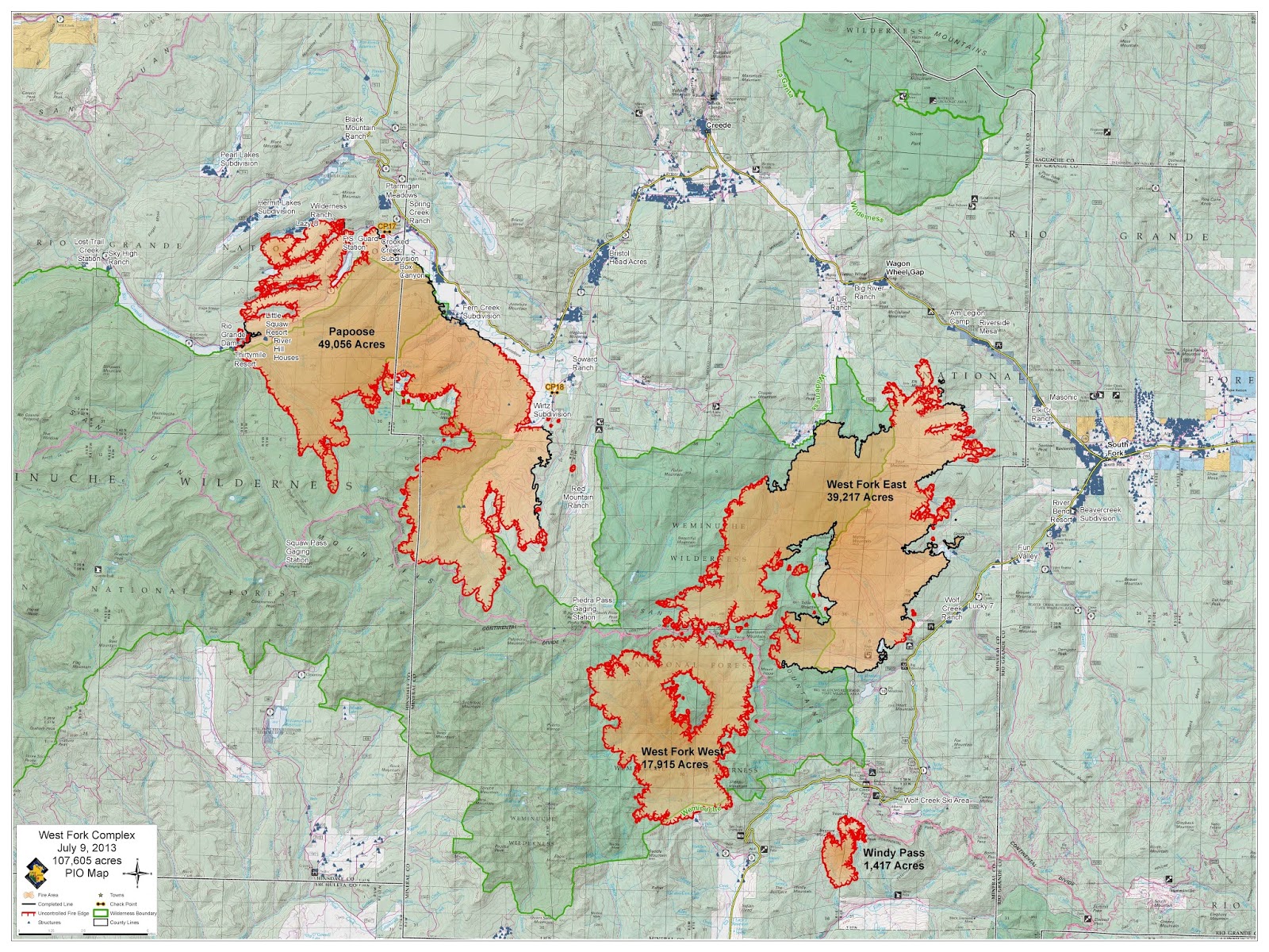
July 9
Fire Perimeter Map
West Fork Complex
 The above map is also available as a pdf at: http://inciweb.nwcg.gov/photos/COSJF/2013-06-18-1720-West-Fork-Complex/related_files/2013_07_09-11.15.52.425-CDT.pdf
July 8
Evacuation Map
West Fork Complex

July 5
No infrared flight was flown last night due to cloud cover.
West Fork Complex
Spruce Mortality

July 4
Papoose Fire

West Fork and Windy Pass

July 3
Papoose Fire
West Fork and Windy Pass

July 2
Papoose Fire
West Fork and Windy Pass

July 1
Papoose Fire

West Fork and Windy Pass

June 30
Papoose Fire

West Fork and Windy Pass

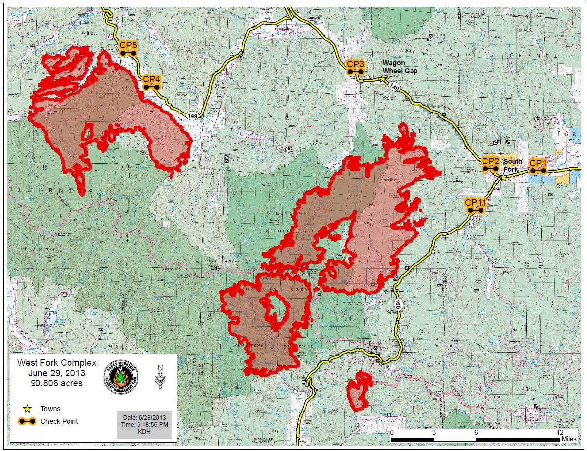
June 29
Due to unfavorable weather, the infrared flight scheduled for last night was not flown. This is the most recent fire perimeter map that we have.
June 28

Understanding that this Blogspot blog is not the standard Inciweb posting, please attempt to post higher-resolution images (or links to such images). The lower-resolution images posted are insufficient to determine if the wildfire has moved toward specific locations of which a viewer might be interested.
ReplyDeleteHi
ReplyDeleteIf we try to put a larger map on there it does not seem to fit in the blog. What you could do is right click on the map and select Save Picture As... you can then download it to your pc and use a photo viewer to zoom in and see the features better.